Rattlesnake Flat and Reid Neilson Draw
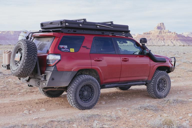
I’m good at avoiding social engagements. It is all the easier when you have a hobby that can take you far away into the wilderness. On Easter Weekend I put this expertise into play and ended up touring a portion of the San Rafael Swell Recreation Area located in central Utah.
Many people end up at the majestic cliffs dubbed The Wedge in the northern part of the Swell. But there is a great deal more to see. I had previously visited Black Dragon Canyon and The Wedge, which were each beautiful in their own unique ways. Yet there could be more beauty out there and I was going to find it.
I approached the Swell from the north through Price. The weather was surprising fair for early April. While overcast in the morning with in the 50s F it usually warmed to the mid 80s and sunny in the afternoon. I took highway 10 south and diverted to the Green River Cutoff Road. This eventually led to Buckhorn Draw Road that squiggles and descends through the majestic canyon next to The Wedge.
There are many camp sites along the canyon and a few could have provided beautiful sunset or sunrise pictures. The canyon extends at a diagonal from the north west to the south east. This would allow for a dramatic contrast of sunlight. But there was a lot of time left in the day and I continued on southward into the swell.
After crossing the San Rafael River the land opened to the desert and plateaus. There are many branching roads in this section. Around Calf Mesa and down Cane Wash, Oil Well Flat, or Road Hollow. All trails looked inspiring but I was aiming for a timid trip. My 4Runner had gone under the knife the week prior with new suspension and tires. I was re-learning my truck and what was rubbing where. Not the best time to push my limits.
Rattlesnake Flat
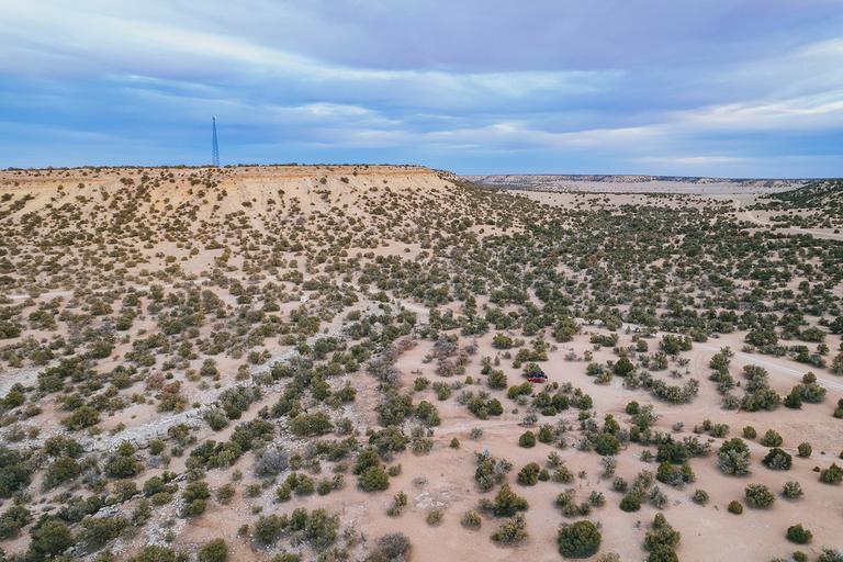
I stuck to the timid Buckhorn Draw Road until around The Sinkhole near I-70. I forked off here to the Rattlesnake Flat area and found a dispersed campsite in an area covered by shrubby cedar trees.
There was a cellular radio tower on the nearby plateau, which gave me the best 5G connection I’ve ever experienced. I’m sure me and the other 3 people connected to the tower were barely pushing 1% of capacity. As I didn’t have a specific destination past where I had just arrived, it was helpful to have a data connection to plan for the next two days of exploring the area.
Fix-it-Pass, the Eva Conover Trail, and Devil’s Racetrack had been on my shortlist for the past few years. All are challenging trails and require capable vehicles driven with finesse. I had recently entered the realm of capable vehicle with 35" tires but I was mere hours into it. To ease into more challenging terrain I decided to scout around the beginnings of these trails until I ran out of time.
On the following morning I got back on Buckhorn Draw Road and headed West back to the I-70 on-ramp. However, I didn’t get back on the highway but crossed it to reach the Heart of Sinbad Road. Taking me farther away from the dramatic landscape of the San Rafael Reef, I entered the boring southern central flat plateau.
While making good time I decided to take a detour to see if I could reach the West side of the San Rafael Reef. How great would it be to discover an unheard of majestic view of the Reef? On an unnamed road crossing I went South East. The scrubby flat landscape gently descended and the plateau started to mildly breakup with the beginning of Georges Draw.
While trying to get to the Reef I overlooked an interesting slot canyon. Crawford Draw trail head was just a short detour off the road I was traveling and could have been a good shelter from the growing heat of the day.
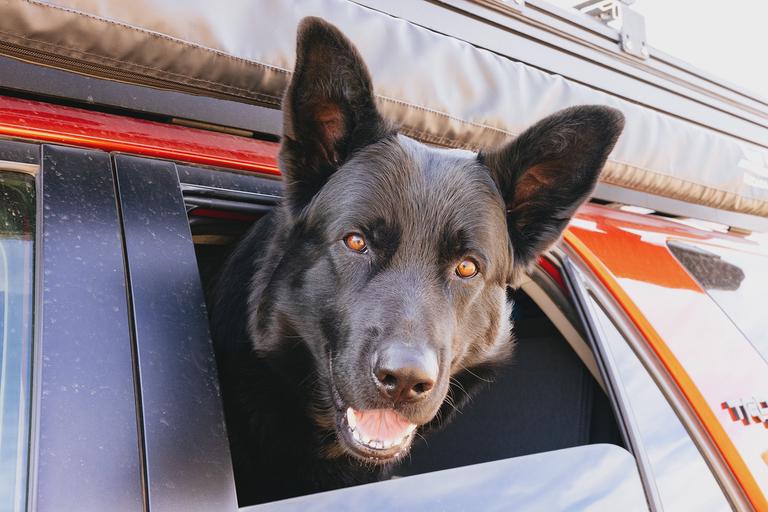
Instead I kept pressing South East. Eventually I ran out of road with a significant hike left to reach the Reef. Although it was early April the temperature must have been in the upper 80s. Not necessarily a problem for myself but for my entirely black haired German Shepherd buddy it would have been rather unpleasant.
Reid Neilson Draw
Returning back to the crossroads with the Heart of Sinbad Road I started to make my way into the Reid Nelson Draw. A fun aspect of this road is that it goes underneath I-70. There is a plain concrete passageway underneath that is a fun change up from the normal overpass bridges. The south side of the dirt road is aggressively eroded where the concrete meets the dirt. In order to ease the transition there are piles of rocks stacked up to accommodate vehicles.
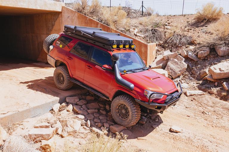
Once on the north side of I-70 the road becomes radically backcountry. The ruts are sometimes extreme and will flex your suspension to a creaky limit. It was here that I heard and felt the tolerances my new 35" tires had on my small 4Runner wheel wells. I can only imagine this condition is due to the isolated nature of the section of road coupled with use limited to only aggressive off-road vehicles.
Past the tunnel, much of the terrain is a flat and gentle plateau that wraps around the south side of Fix-it-Pass. But this is a bit misleading because the roads are heavily rutted and sometimes brings your vehicle to an uneasy angle. But this has the benefit of making the area isolated from the general population. There aren’t going to be large camping trailers or minivans trawling over the deep ruts. Additionally, there are plenty of spots to camp scattered along the edge of the plateau with great views of Fix-it-Pass.
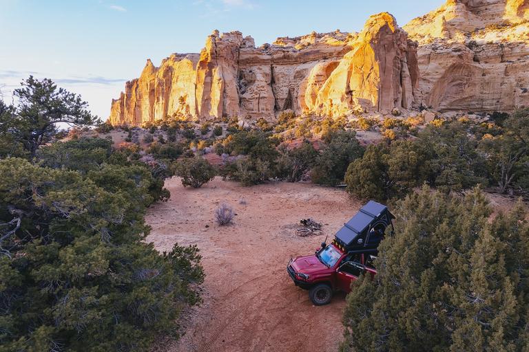
I chose a camping spot farther back in a secluded area of large cedar trees. The valley was heavily used by grazing cattle, which resulted in dried cow pies being everywhere. The nearby sandstone cliffs made for a dramatic outlined against the sky as it got dark.
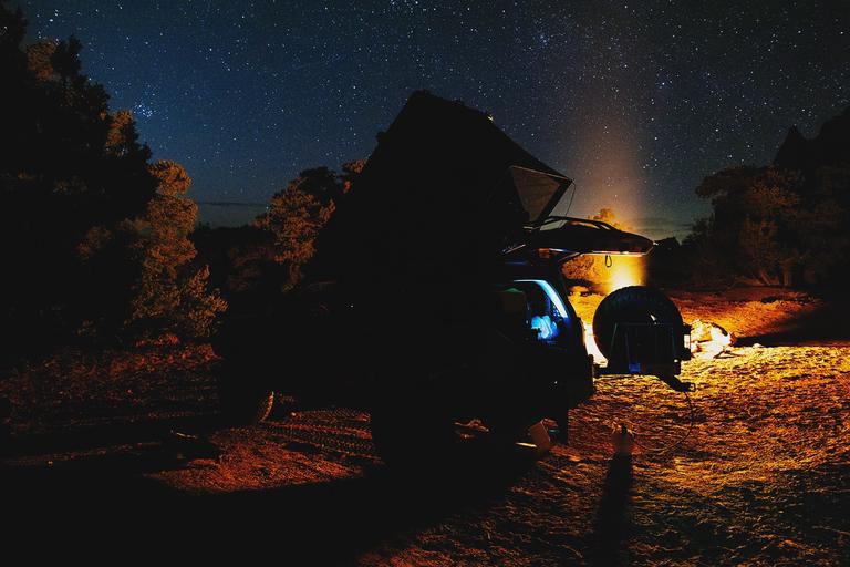
The following morning I went on a sandy hike to the nearby pictographs. I had to take the road the long way around due to the stealthy presence of cactus between all the ruddy desert grass. Protecting the feet of my dog was worth the sacrifice of extra walking.
Seeing the pictographs was unique because they were both isolated yet trashed. It took significant capability to reach them and I doubt most people driving by on the nearby interstate would even know they were there. But on top of that the grazing cattle in the area seemed to have loved hanging out near the pictographs because there were a huge concentration of dried cow pies right next to it. I imagine the fence built around the pictograph area was built specifically to keep out the aggressive bowels of these grazing cattle.
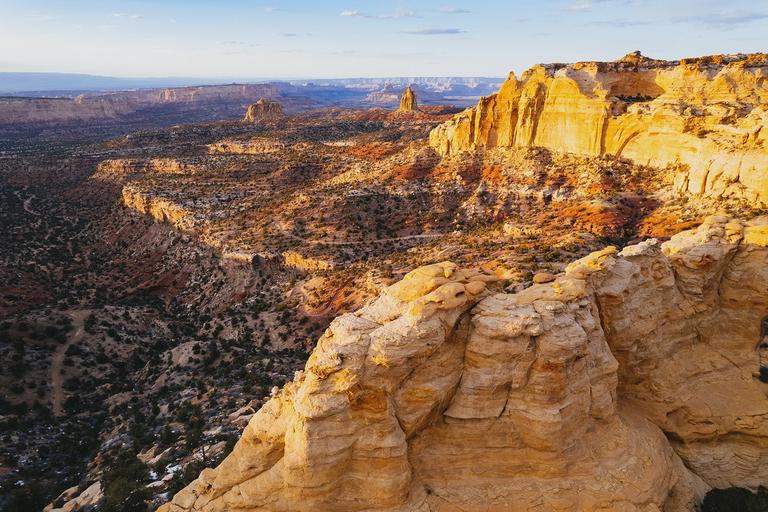
After spending some time witnessing history it was starting to get warmer and I headed back to camp with my dog slogging along. He loves exploring with me but with his medium length black hair it makes for a uncomfortable experience if the weather is at all warm. Luckily we made it back to camp and we both cooled off in the shade and drank plenty of water.
I had planned on staying for a few hours longer by just relaxing and enjoying the area but I saw a text from my family announcing Easter dinner would be that afternoon. After a few days of enjoying the San Rafael Swell area I packed up and headed back home.
⁂